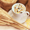
We aimed to evaluate the effect of freeze-drying and vacuum-drying on moisture, water activities (aw), total soluble solid (TSS), hydroxymethylfurfural (HMF), diastase activity, total phenolic content (TPCs), and antioxidant activities (ABTS, DPPH, FRAP, ORAC) of longan (Dimocarpus longan Lour.) blossom honey and Siam weed (Chromolaena odorata Lour.) honey. The fresh longan blossom honey and Siam weed honey were collected from a local apiarist in Northern Thailand. Freeze-drying at 0.013 kPa, −54℃ for 72 h or vacuum-drying at 2.5 kPa at 60 ℃ for 12 h was applied to dehydrate fresh honey. The moisture of freeze-dried samples was 10.10% for longan blossom honey and 11.50% for Siam weed honey, and the aw of both freeze-dried honeys was 0.43. Freeze- and vacuum-dried produced more TSS than fresh honey did (p ≤ 0.05). However, the amounts of TSS derived freeze-dry and vacuum-dry were not significantly different. Freeze-dried honey contained the highest HMF and the lowest diastase activity regardless of honey origins (p ≤ 0.05). Drying processes significantly increased the TPCs levels of honey (approximately 2 folds by freeze-drying method). The antioxidant activity of dried honey was significantly higher than that of fresh honey. It was observed that the freeze-drying method tended to better preserve the antioxidant activity of honey compared to vacuum-drying methods in both types of honey. The results indicated that drying processes significantly affect the quality of dried honey, including TSS, HMF, diastase activity, TPCs, and antioxidant activity. In this study, freeze-drying emerged as the relatively low temperature drying method that can preserve the quality of honey, especially in terms of TPCs and antioxidant activity.
Citation: Rossaporn Jiamjariyatam, Orachorn Mekkerdchoo, Pakkapong Phucharoenrak, Lu Zheng. Effects of freeze-drying and vacuum-drying on the quality, total phenolic contents, and antioxidant activities of bee honey in northern Thailand[J]. AIMS Agriculture and Food, 2024, 9(2): 430-444. doi: 10.3934/agrfood.2024025
We aimed to evaluate the effect of freeze-drying and vacuum-drying on moisture, water activities (aw), total soluble solid (TSS), hydroxymethylfurfural (HMF), diastase activity, total phenolic content (TPCs), and antioxidant activities (ABTS, DPPH, FRAP, ORAC) of longan (Dimocarpus longan Lour.) blossom honey and Siam weed (Chromolaena odorata Lour.) honey. The fresh longan blossom honey and Siam weed honey were collected from a local apiarist in Northern Thailand. Freeze-drying at 0.013 kPa, −54℃ for 72 h or vacuum-drying at 2.5 kPa at 60 ℃ for 12 h was applied to dehydrate fresh honey. The moisture of freeze-dried samples was 10.10% for longan blossom honey and 11.50% for Siam weed honey, and the aw of both freeze-dried honeys was 0.43. Freeze- and vacuum-dried produced more TSS than fresh honey did (p ≤ 0.05). However, the amounts of TSS derived freeze-dry and vacuum-dry were not significantly different. Freeze-dried honey contained the highest HMF and the lowest diastase activity regardless of honey origins (p ≤ 0.05). Drying processes significantly increased the TPCs levels of honey (approximately 2 folds by freeze-drying method). The antioxidant activity of dried honey was significantly higher than that of fresh honey. It was observed that the freeze-drying method tended to better preserve the antioxidant activity of honey compared to vacuum-drying methods in both types of honey. The results indicated that drying processes significantly affect the quality of dried honey, including TSS, HMF, diastase activity, TPCs, and antioxidant activity. In this study, freeze-drying emerged as the relatively low temperature drying method that can preserve the quality of honey, especially in terms of TPCs and antioxidant activity.

| [1] |
Zerrouk S, Seijo MC, Escuredo O, et al. (2018) Characterization of Ziziphus lotus (jujube) honey produced in Algeria. J Apic Res 57: 166–174. https://doi.org/10.1080/00218839.2017.1399663 doi: 10.1080/00218839.2017.1399663

|
| [2] |
Bicudo de Almeida-Muradian L, Monika Barth O, Dietemann V, et al. (2020) Standard methods for Apis mellifera honey research. J Apic Res 59: 1–62. https://doi.org/10.1080/00218839.2020.1738135 doi: 10.1080/00218839.2020.1738135
|
| [3] | Zammit Young GW, Blundell R (2023) A review on the phytochemical composition and health applications of honey. Heliyon 9: e12507. https://doi.org/10.1016/j.heliyon.2022.e12507 |
| [4] |
Zhang Y, Li XQ, Li HM, et al. (2019) Antibiotic residues in honey: A review on analytical methods by liquid chromatography tandem mass spectrometry. TrAC, Trends Anal Chem 110: 344–356. https://doi.org/10.1016/j.trac.2018.11.015 doi: 10.1016/j.trac.2018.11.015
|
| [5] |
Samborska K (2019) Powdered honey—drying methods and parameters, types of carriers and drying aids, physicochemical properties and storage stability. Trends Food Sci Technol 88: 133–142. https://doi.org/10.1016/j.tifs.2019.03.019 doi: 10.1016/j.tifs.2019.03.019
|
| [6] |
Osés SM, Cantero L, Puertas G, et al. (2022) Antioxidant, antimicrobial and anti-inflammatory activities of ling-heather honey powder obtained by different methods with several carriers. LWT 159: 113235. https://doi.org/10.1016/j.lwt.2022.113235 doi: 10.1016/j.lwt.2022.113235
|
| [7] | The Brainy Insights (2022) Dried Honey Market Size by Category (Conventional and Organic), Form Type (Granular and Powder), Application[Pharmaceuticals (Supplements, Ointment, and Medicines), Food and Beverages (Confectioneries and Bakery, Coffee, Tea, Juice, Frozen Desserts, and Others) and Personal Care and Cosmetics], Sales Channel (Specialty Stores, Supermarkets and Hypermarkets, Retail Stores and Online), Regions, Global Industry Analysis, Share, Growth, Trends, and Forecast 2022 to 2030. Pune, Maharashtra, India: The Brainy Insights. TBI-12926 TBI-12926. 235p. |
| [8] | IndexBox Inc (2023) Thailand-Honey-Market Analysis, Forecast, Size, Trends and Insights California, USA: IndexBox Inc, . 0409 0409. |
| [9] |
Wanjai C, Sringarm K, Santasup C, et al. (2012) Physicochemical and microbiological properties of longan, bitter bush, sunflower and litchi honeys produced by Apis mellifera in Northern Thailand. J Apic Res 51: 36–44. https://doi.org/10.3896/IBRA.1.51.1.05 doi: 10.3896/IBRA.1.51.1.05
|
| [10] | Maitip J, Sanpa S, Burgett M, et al. (2023) Antimicrobial activity from five species of stingless bee (Apidae meliponini) honey from South East Asia (Thailand). In: Razak BA, Chilek TZT, Saputra J (Eds.), Recent Advances in Global Meliponiculture, IGI Global, 53–68. https://doi.org/10.4018/978-1-6684-6265-2.ch003 |
| [11] | Chen YH, Chuah WC, Chye FY (2021) Effect of drying on physicochemical and functional properties of stingless bee honey. J Food Proc Preserv 45: e15328. https://doi.org/10.1111/jfpp.15328 |
| [12] |
Samborska K, Jedlińska A, Wiktor A, et al. (2019) The effect of low-temperature spray drying with dehumidified air on phenolic compounds, antioxidant activity, and aroma compounds of rapeseed honey powders. Food Bioprocess Technol 12: 919–932. https://doi.org/10.1007/s11947-019-02260-8 doi: 10.1007/s11947-019-02260-8
|
| [13] |
Sarabandi K, Peighambardoust SH, Sadeghi Mahoonak AR, et al. (2018) Effect of different carriers on microstructure and physical characteristics of spray dried apple juice concentrate. J Food Sci Technol 55: 3098–3109. https://doi.org/10.1007/s13197-018-3235-6 doi: 10.1007/s13197-018-3235-6
|
| [14] |
Sramek M, Woerz B, Horn H, et al. (2016) Preparation of High-Grade Powders from Honey–Glucose Syrup Formulations by Vacuum Foam-Drying Method. J Food Proc Preserv 40: 790–797. https://doi.org/10.1111/jfpp.12660 doi: 10.1111/jfpp.12660
|
| [15] |
Sahu JK (2008) The effect of additives on vacuum dried honey powder properties. Int J Food Eng 4: 9. https://doi.org/doi:10.2202/1556-3758.1356 doi: 10.2202/1556-3758.1356
|
| [16] |
Vardanega R, Muzio AFV, Silva EK, et al. (2019) Obtaining functional powder tea from Brazilian ginseng roots: Effects of freeze and spray drying processes on chemical and nutritional quality, morphological and redispersion properties. Food Res Int 116: 932–941. https://doi.org/10.1016/j.foodres.2018.09.030 doi: 10.1016/j.foodres.2018.09.030
|
| [17] |
Raja KS, Taip FS, Azmi MMZ, et al. (2019) Effect of pre-treatment and different drying methods on the physicochemical properties of Carica papaya L. leaf powder. J Saudi Soc Agric Sci 18: 150–156. https://doi.org/10.1016/j.jssas.2017.04.001 doi: 10.1016/j.jssas.2017.04.001
|
| [18] |
How YK, Siow LF (2020) Effects of convection-, vacuum-and freeze-drying on antioxidant, physicochemical properties, functional properties and storage stability of stink bean (Parkia speciosa) powder. J Food Sci Technol 57: 4637–4648. https://doi.org/10.1007/s13197-020-04501-7 doi: 10.1007/s13197-020-04501-7
|
| [19] |
Mutlu C, Erbas M (2023) Evaluating the effects of different drying methods, carrier materials and their ratios to produce bioactive honey-like powder. J Apic Res 62: 364–373. https://doi.org/10.1080/00218839.2021.1885877 doi: 10.1080/00218839.2021.1885877
|
| [20] | Horwitz W, International A (2002) Official methods of analysis of AOAC International. Gaithersburg, Md.: AOAC International Gaithersburg, Md. |
| [21] |
Sarkar A, Hossain MW, Alam M, et al. (2023) Drying conditions and varietal impacts on physicochemical, antioxidant and functional properties of onion powder. J Agric Food Res 12: 100578. https://doi.org/10.1016/j.jafr.2023.100578 doi: 10.1016/j.jafr.2023.100578
|
| [22] | Sales Junior RdO, Gomes-Filho JE, Almeida WCd, et al. (2022) Evaluation of pH and total soluble solid (° brix) on the cariogenic and erosive potential of milk powder infantile formula. Res, Soc Dev 11: e588111537063. https://doi.org/10.33448/rsd-v11i15.37063 |
| [23] | Bogdanov S (2002) Harmonised methods of the international honey commission. International Honey Commission (IHC), 1–62. |
| [24] |
Akther S, Jothi JS, Badsha MR, et al. (2023) Drying methods effect on bioactive compounds, phenolic profile, and antioxidant capacity of mango powder. J King Saud Univ-Sci 35: 102370. https://doi.org/10.1016/j.jksus.2022.102370 doi: 10.1016/j.jksus.2022.102370
|
| [25] |
Kamchonemenukool S, Buasum W, Weerawatanakorn M, et al. (2023) Short-chain fructooligosaccharide synthesis from sugarcane syrup with commercial enzyme preparations and some physical and antioxidation properties of the syrup and syrup powder. Foods 12: 2895. https://doi.org/10.3390/foods12152895 doi: 10.3390/foods12152895
|
| [26] |
Guldas M, Demircan H, Cakmak I, et al. (2022) Antioxidant and bioaccessibility characteristics of functional fruit and vegetable honeys produced by innovative method. Food BioSci 48: 101732. https://doi.org/10.1016/j.fbio.2022.101732 doi: 10.1016/j.fbio.2022.101732
|
| [27] |
Ranneh Y, Ali F, Zarei M, et al. (2018) Malaysian stingless bee and Tualang honeys: A comparative characterization of total antioxidant capacity and phenolic profile using liquid chromatography-mass spectrometry. LWT 89: 1–9. https://doi.org/10.1016/j.lwt.2017.10.020 doi: 10.1016/j.lwt.2017.10.020
|
| [28] |
Ahmad I, Xiong Z, Xiong H, et al. (2023) Physicochemical, rheological and antioxidant profiling of yogurt prepared from non-enzymatically and enzymatically hydrolyzed potato powder under refrigeration. Food Sci Hum Wellness 12: 69–78. https://doi.org/10.1016/j.fshw.2022.07.024 doi: 10.1016/j.fshw.2022.07.024
|
| [29] |
Kowalska G, Rosicka-Kaczmarek J, Miśkiewicz K, et al. (2021) Influence of rye bran heteropolysaccharides on the physicochemical and antioxidant properties of honeydew honey microcapsules. Food Bioprod Proc 130: 171–181. https://doi.org/10.1016/j.fbp.2021.09.014 doi: 10.1016/j.fbp.2021.09.014
|
| [30] |
Khan SU, Anjum SI, Rahman K, et al. (2018) Honey: Single food stuff comprises many drugs. Saudi J Biol Sci 25: 320–325. https://doi.org/10.1016/j.sjbs.2017.08.004 doi: 10.1016/j.sjbs.2017.08.004
|
| [31] |
Singh I, Singh S (2018) Honey moisture reduction and its quality. J Food Sci Technol 55: 3861–3871. https://doi.org/10.1007/s13197-018-3341-5 doi: 10.1007/s13197-018-3341-5
|
| [32] |
Akhmazillah MFN, Farid MM, Silva FVM (2013) High pressure processing (HPP) of honey for the improvement of nutritional value. Innovative Food Sci Emerging Technol 20: 59–63. https://doi.org/10.1016/j.ifset.2013.06.012 doi: 10.1016/j.ifset.2013.06.012
|
| [33] |
Umesh Hebbar H, Rastogi NK, Subramanian R (2008) Properties of dried and intermediate moisture honey products: A review. Int J Food Prop 11: 804–819. https://doi.org/10.1080/10942910701624736 doi: 10.1080/10942910701624736
|
| [34] |
Aykas DP (2023) Determination of possible adulteration and quality assessment in commercial honey. Foods 12: 523. https://doi.org/10.3390/foods12030523 doi: 10.3390/foods12030523
|
| [35] |
Nedic N, Gojak M, Zlatanović I, et al. (2020) Study of vacuum and freeze drying of bee honey. Therm Sci 24: 194–194. https://doi.org/10.2298/TSCI200317194N doi: 10.2298/TSCI200317194N
|
| [36] |
Seerangurayar T, Manickavasagan A, Al-Ismaili AM, et al. (2017) Effect of carrier agents on flowability and microstructural properties of foam-mat freeze dried date powder. J Food Eng 215: 33–43. https://doi.org/10.1016/j.jfoodeng.2017.07.016 doi: 10.1016/j.jfoodeng.2017.07.016
|
| [37] |
Ucar TM, Karadag A (2019) The effects of vacuum and freeze-drying on the physicochemical properties and in vitro digestibility of phenolics in oyster mushroom (Pleurotus ostreatus). J Food Meas Charact 13: 2298–2309. https://doi.org/10.1007/s11694-019-00149-w doi: 10.1007/s11694-019-00149-w
|
| [38] |
Zamora MC, Chirife J, Roldán D (2006) On the nature of the relationship between water activity and % moisture in honey. Food Control 17: 642–647. https://doi.org/10.1016/j.foodcont.2005.04.002 doi: 10.1016/j.foodcont.2005.04.002
|
| [39] |
Jalgaonkar K, Mahawar MK, Vishwakarma RK, et al. (2020) Optimization of process condition for preparation of sapota bar using Refractance window drying method. Drying Technol 38: 269–278. https://doi.org/10.1080/07373937.2018.1482314 doi: 10.1080/07373937.2018.1482314
|
| [40] |
Vu ND, Nguyen VM, Tran TT (2023) Effects of pH, total soluble solids, and pectin concentration on color, texture, vitamin C, and sensory quality of mango fruit bar. Int J Food Sci 2023: 6618300. https://doi.org/10.1155/2023/6618300 doi: 10.1155/2023/6618300
|
| [41] |
Shapla UM, Solayman M, Alam N, et al. (2018) 5-hydroxymethylfurfural (HMF) levels in honey and other food products: effects on bees and human health. Chem Cent J 12: 35. https://doi.org/10.1186/s13065-018-0408-3 doi: 10.1186/s13065-018-0408-3
|
| [42] |
Lee YC, Shlyankevich M, Jeong HK, et al. (1995) Bioactivation of 5-hydroxymethyl-2-furaldehyde to an electrophilic and mutagenic allylic sulfuric acid ester. Biochem Biophys Res Commun 209: 996–1002. https://doi.org/10.1006/bbrc.1995.1596 doi: 10.1006/bbrc.1995.1596
|
| [43] |
Glatt H, Schneider H, Liu Y (2005) V79-hCYP2E1-hSULT1A1, a cell line for the sensitive detection of genotoxic effects induced by carbohydrate pyrolysis products and other food-borne chemicals. Mutat Res/Genet Toxicol Environ Mutagen 580: 41–52. https://doi.org/10.1016/j.mrgentox.2004.11.005 doi: 10.1016/j.mrgentox.2004.11.005
|
| [44] |
Monien BH, Engst W, Barknowitz G, et al. (2012) Mutagenicity of 5-hydroxymethylfurfural in V79 cells expressing human SULT1A1: Identification and mass spectrometric quantification of DNA adducts formed. Chem Res Toxicol 25: 1484–1492. https://doi.org/10.1021/tx300150n doi: 10.1021/tx300150n
|
| [45] |
Kanar Y, Mazı BG (2019) HMF formation, diastase activity and proline content changes in bee pollen dried by different drying methods. LWT 113: 108273. https://doi.org/10.1016/j.lwt.2019.108273 doi: 10.1016/j.lwt.2019.108273
|
| [46] |
Bogdanov S, Lüllmann C, Martin P, et al. (2015) Honey quality and international regulatory standards: Review by the International Honey Commission. Bee World 80: 61–69. https://doi.org/10.1080/0005772X.1999.11099428 doi: 10.1080/0005772X.1999.11099428
|
| [47] |
Thrasyvoulou A, Tananaki C, Goras G, et al. (2018) Legislation of honey criteria and standards. J Apic Res 57: 88–96. https://doi.org/10.1080/00218839.2017.1411181 doi: 10.1080/00218839.2017.1411181
|
| [48] |
Cianciosi D, Forbes-Hernández TY, Afrin S, et al. (2018) Phenolic compounds in honey and their associated health benefits: A review. Molecules 23: 2322. https://doi.org/10.3390/molecules23092322 doi: 10.3390/molecules23092322
|
| [49] |
Chua LS, Rahaman NL, Adnan NA, et al. (2013) Antioxidant activity of three honey samples in relation with their biochemical components. J Anal Methods Chem 2013: 313798. https://doi.org/10.1155/2013/313798 doi: 10.1155/2013/313798
|
| [50] |
Starowicz M, Ostaszyk A, Zieliński H (2021) The relationship between the browning index, total phenolics, color, and antioxidant activity of polish-originated honey samples. Foods 10: 967. https://doi.org/10.3390/foods10050967 doi: 10.3390/foods10050967
|
| [51] |
Nedic N, Kalaba M, Radišić P, et al. (2022) Polyphenolic and chemical profiles of honey from the Tara Mountain in Serbia. Front Nutr 9: 941463. https://doi.org/10.3389/fnut.2022.941463 doi: 10.3389/fnut.2022.941463
|
| [52] |
Nyarko K, Boozer K, Greenlief CM (2023) Profiling of the polyphenol content of honey from different geographical origins in the United States. Molecules 28: 5011. https://doi.org/10.3390/molecules28135011 doi: 10.3390/molecules28135011
|
| [53] | Kamiloglu S, Toydemir G, Boyacioglu D, et al. (2016) A review on the effect of drying on antioxidant potential of fruits and vegetables. Crit Rev Food Sci Nutr 56: S110–S129. https://doi.org/10.1080/10408398.2015.1045969 |
| [54] |
Jiang N, Liu C, Li D, et al. (2017) Evaluation of freeze drying combined with microwave vacuum drying for functional okra snacks: Antioxidant properties, sensory quality, and energy consumption. LWT-Food Sci Technol 82: 216–226. https://doi.org/10.1016/j.lwt.2017.04.015 doi: 10.1016/j.lwt.2017.04.015
|
| [55] | Kieu Tran TM, Kirkman T, Nguyen M, et al. (2020) Effects of drying on physical properties, phenolic compounds and antioxidant capacity of Robusta wet coffee pulp (Coffea canephora). Heliyon 6: e04498. https://doi.org/10.1016/j.heliyon.2020.e04498 |
| [56] |
Paul ID, Das M (2018) Effect of freeze, microwave-convective hot air, vacuum and dehumidified air drying on total phenolics content, anthocyanin content and antioxidant activity of jamun (Syzygium cumini L.) pulp. J Food Sci Technol 55: 2410–2419. https://doi.org/10.1007/s13197-018-3158-2 doi: 10.1007/s13197-018-3158-2
|
| [57] |
İzli G (2017) Total phenolics, antioxidant capacity, colour and drying characteristics of date fruit dried with different methods. Ciência e Tecnologia de Alimentos 37: 139–147. https://doi.org/10.1590/1678-457x.14516 doi: 10.1590/1678-457x.14516
|
| [58] |
Sayin FK, Alkan SB (2015) The effect of pickling on total phenolic contents and antioxidant activity of 10 vegetables. Food Health 1: 135–141. https://doi.org/10.3153/JFHS15013 doi: 10.3153/JFHS15013
|
| [59] |
Hu D, Liu X, Qin Y, et al. (2023) The impact of different drying methods on the physical properties, bioactive components, antioxidant capacity, volatile components and industrial application of coffee peel. Food Chem: X 19: 100807. https://doi.org/10.1016/j.fochx.2023.100807 doi: 10.1016/j.fochx.2023.100807
|
| [60] |
Lachman J, Orsák M, Hejtmánková A, et al. (2010) Evaluation of antioxidant activity and total phenolics of selected Czech honeys. LWT-Food Sci Technol 43: 52–58. https://doi.org/10.1016/j.lwt.2009.06.008 doi: 10.1016/j.lwt.2009.06.008
|
| [61] |
Liang N, Kitts DD (2014) Antioxidant property of coffee components: Assessment of methods that define mechanisms of action. Molecules 19: 19180–19208. https://doi.org/10.3390/molecules191119180 doi: 10.3390/molecules191119180
|
| [62] |
Valadez-Carmona L, Plazola-Jacinto CP, Hernández-Ortega M, et al. (2017) Effects of microwaves, hot air and freeze-drying on the phenolic compounds, antioxidant capacity, enzyme activity and microstructure of cacao pod husks (Theobroma cacao L.). Innovative Food Sci Emerging Technol 41: 378–386. https://doi.org/10.1016/j.ifset.2017.04.012 doi: 10.1016/j.ifset.2017.04.012
|
| [63] |
Mella C, Vega-Gálvez A, Uribe E, et al. (2022) Impact of vacuum drying on drying characteristics and functional properties of beetroot (Beta vulgaris). Appl Food Res 2: 100120. https://doi.org/10.1016/j.afres.2022.100120 doi: 10.1016/j.afres.2022.100120
|
| [64] |
Subbiah V, Duan X, Agar OT, et al. (2023) Comparative study on the effect of different drying techniques on phenolic compounds in Australian beach-cast brown seaweeds. Algal Res 72: 103140. https://doi.org/10.1016/j.algal.2023.103140 doi: 10.1016/j.algal.2023.103140
|
| [65] |
Gül A, Pehlivan T (2018) Antioxidant activities of some monofloral honey types produced across Turkey. Saudi J Biol Sci 25: 1056–1065. https://doi.org/10.1016/j.sjbs.2018.02.01 doi: 10.1016/j.sjbs.2018.02.01
|

Rossaporn Jiamjariyatam, Orachorn Mekkerdchoo, Pakkapong Phucharoenrak, Lu Zheng. Effects of freeze-drying and vacuum-drying on the quality, total phenolic contents, and antioxidant activities of bee honey in northern Thailand[J]. AIMS Agriculture and Food, 2024, 9(2): 430-444. doi: 10.3934/agrfood.2024025


 DownLoad: